
Blaine ZIP Code Coverage
The official Minnesota city and county listing places Blaine under three ZIP codes: 55014, 55434, and 55449. That is Blaine municipal use, not a promise that every address in a ZIP lies inside Blaine. The Minnesota city and county listing, Anoka County’s ZIP map, Blaine GIS layers, and USPS address lookup each answer a different Blaine geography question. Keep the Blaine municipality, postal city, and delivery ZIP in separate notes.
| ZIP | Blaine coverage described in official sources | Post-office context | Search caution |
|---|---|---|---|
| 55014 | State listing includes Blaine; county map shows northern and eastern Anoka-area context for Blaine | Circle Pines station appears in nearby USPS results | Verify the exact Blaine address because postal city labeling can differ from Blaine |
| 55434 | State listing includes Blaine | A dedicated retail-station assignment for every Blaine address was not located | Do not infer a Blaine post office or city from the number alone |
| 55449 | State listing includes Blaine and research identifies the core Blaine postal area | Blaine Post Office uses a Minneapolis postal-city label | Municipal Blaine and the USPS city string are separate Blaine fields |
The Blaine ZIP code directory is therefore a Blaine address-validation tool, not a map of neighborhoods or a list of residents. No official ZIP-wide Blaine population or registration total was located. For a particular Blaine address, USPS remains the source for delivery labeling, while Blaine and county GIS establish the parcel’s geographic context.
Blaine 55014 Postal Context
55014 is one of the three ZIP codes tied to Blaine in the state listing, yet its postal context can point toward Circle Pines. The county ZIP map is helpful for broad Blaine orientation, but it should not assign a delivery ZIP to a particular Blaine household. Postal geography is built for mail delivery, not for Blaine municipal boundaries. An address that belongs to Blaine for city services can still return a neighboring postal-city label or cross an approximate ZIP-map area.
Use the USPS ZIP lookup instructions with the full Blaine street address, city, and state. The USPS guidance also allows a city-and-state search for ZIPs, but it warns that a ZIP result does not confirm a person or company. When Blaine research begins from 55014, preserve the postal result and then search the physical address in Anoka County GIS. This keeps a mail label from being mistaken for proof of Blaine municipal location or residency.
Blaine 55434 Address Checks
55434 is also listed for Blaine by the Minnesota Department of Public Safety city and county document. The research did not locate an official, dedicated retail-station assignment that applies to every Blaine 55434 address. That absence is useful for Blaine research. It means a search should not add an assumed station, postal city, or neighborhood name simply because a Blaine address carries 55434. Let the current USPS by-address result supply the delivery information.
After the postal result is known, use the Blaine city and county map layers to test the actual parcel. Anoka GIS can show a Blaine physical situs, while Blaine’s boundaries service includes City Border and Anoka County ZIP Code layers. They can be compared visually without treating either Blaine layer as a resident directory. A tax mailing address shown on a Blaine parcel card is still different from the delivery address and may point outside Blaine. Each Blaine field needs its own label.
Blaine 55449 Postal Label
55449 illustrates Blaine’s clearest postal-city mismatch. The official USPS location page lists the Blaine Post Office at 10611 Baltimore St NE, Suite 100, with the postal address Minneapolis, MN 55449-9930. The page gives the station phone as 763-784-1208 and lists weekday and Saturday retail hours. That postal label does not move the station out of Blaine. It shows why a municipality and a USPS city string should never be collapsed into the same field.
The Blaine USPS station listing is the source for the image below. It supplies a useful postal reference, while the city border and the parcel record remain the appropriate sources for municipal and property questions.
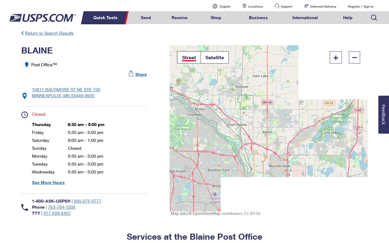
The station’s Minneapolis postal-city wording is a local reminder to record the address, city jurisdiction, postal city, and ZIP separately.
Blaine ZIP Search Fields
Several official tools accept a ZIP, but they use it for different purposes. USPS validates a delivery ZIP for an address or returns ZIP choices for a city and state. MNVotes accepts ZIP Code as one route within a supplied voter-registration check. The Anoka GIS and Blaine boundary services display ZIP geography, but the official research did not document a ZIP-wide assessor people search. Entering 55449, for example, does not produce an official list of all residents.
| Official surface | ZIP-related input or layer | What it returns | What it cannot establish |
|---|---|---|---|
| USPS lookup | Street, city, state, or city and state | Delivery ZIP validation or ZIP choices | Identity of a person or company |
| MNVotes | ZIP Code with required first name, last name, and full date of birth | Registration or address confirmation guidance | A downloadable roll or a list for the ZIP |
| Anoka County GIS | Anoka County ZIP Code layer and parcel search | Geographic and parcel context | A ZIP-wide people search |
| Blaine boundaries service | City Border and ZIP layers | Comparison of municipal and postal geography | A legal parcel survey or household list |
The MNVotes form also needs a full date of birth and a name. It returns a confirmation or mismatch path, not public voter-file results. That distinction follows Minnesota’s voter-record rules and remains important even when the address has already been validated by USPS.
Find Residents by Blaine ZIP
Use a ZIP to check the mail geography around a known address, then switch to address- or parcel-based sources. The process avoids the false idea that a postal area is a public resident roll. It also makes it easier to catch a postal-city mismatch before searching the wrong municipal records. Once an exact address is confirmed, the owner, tax, permit, and recorded-document trails use the parcel or street, not a broad ZIP list.
- Enter the complete street, city, and state in the USPS address lookup and save the delivery ZIP returned for that address.
- Compare that result with the Anoka County ZIP map and the city-border layer for broad geographic context.
- Search the exact street address or PIN in Anoka GIS to identify the parcel situs and its legal description.
- Use MNVotes only when the supplied person’s name and full date of birth are available for a registration confirmation check.
- Follow the address-based record chain when needed. The Blaine street directory explains that street-level workflow without treating a ZIP as a household list.
A lawful-purpose voter-list request has its own state process and is not a ZIP filter for casual name searching. Property tax mailing fields, permit applicants, and deed parties also represent distinct relationships. None should be relabeled as every resident within a postal area.
Blaine ZIP and City Limits
ZIP boundaries and Blaine city limits do not match perfectly because they are maintained for different purposes. The City Border and Anoka County ZIP Code layers can be displayed together in local GIS, while the county map offers a broader view. Compare those layers when an address appears near an edge. The result is an approximation of postal and municipal geography, not a legal survey. For a formal property question, use the parcel description and the county record.
USPS itself provides the strongest local example. A postal address for the Blaine station uses Minneapolis, even though the station serves Blaine. Similarly, 55014 can bring a Circle Pines postal context. A mismatch does not mean the parcel lies outside Blaine, and a Blaine postal string alone does not establish city jurisdiction. Check the exact address in each appropriate system.
- ZIP and ZIP+4
- A ZIP identifies a mail-delivery area. ZIP+4 adds a smaller delivery segment, such as a block, building, or group of addresses.
- PO Box ZIP
- A PO Box ZIP is used for post-office box delivery. It should not be assumed to describe nearby street delivery.
- Unique ZIP
- A unique ZIP is assigned to a single organization or destination. The Blaine research did not identify one to treat as a citywide resident area.
- Carrier route
- A carrier route is a delivery sequence used by USPS. It is not a municipal boundary or a list of people.
Blaine Postal History
No official Blaine ZIP split, realignment year, or ZIP-by-ZIP population or registration total was located. That gap should stay visible in historical research. Date every postal source because delivery conventions can change independently of a parcel, city boundary, or directory entry. When an older deed or telephone directory fails to match a modern address, preserve the old street string and use the parcel legal description, PIN, historic maps, and city GIS assistance rather than guessing a past ZIP boundary.
Blaine’s own history supplies a second reason to test historic locality labels. The city says the area was part of Anoka until Blaine organized as a township in 1877, and Circle Pines and Lexington later drew from land that had been Blaine and Centerville. A historical household can therefore be attached to a different municipality even when its modern location is Blaine. That is a records-history issue, not evidence that a current postal label is wrong.
Blaine Postal-Area Scale
ZIP boundaries cross a large and growing municipal setting, but citywide population figures cannot be divided into ZIP totals without a documented source. Census QuickFacts reported 70,222 Blaine residents in 2020 and a July 2025 estimate of 76,603, while the city’s 2025 economic report displays a different current population figure. The different vintages and methods make those citywide numbers context only. They do not create a count for 55014, 55434, or 55449.
The official USPS ZIP lookup is shown below because it keeps the Blaine ZIP code directory practical: validate the mailing geography first, then move to the exact address, parcel, or record custodian. Postal data is valuable when it stays within that role.
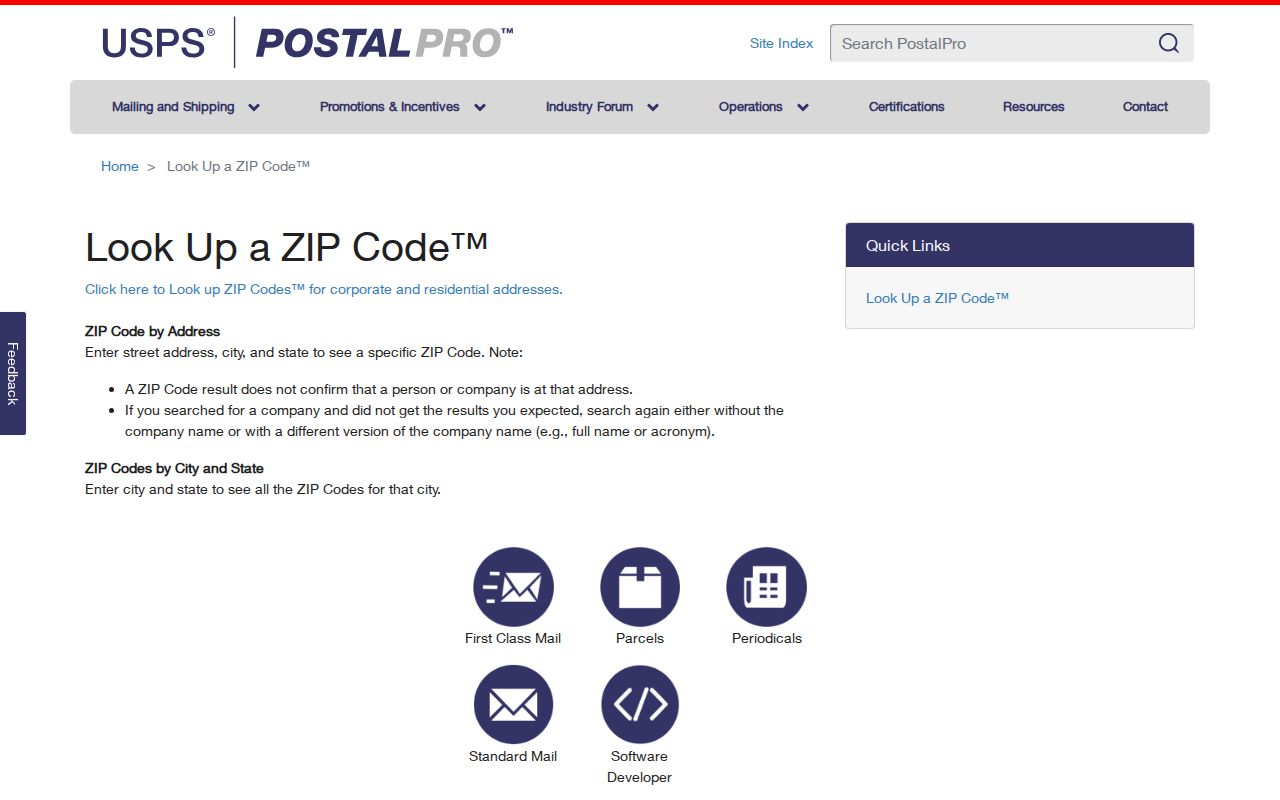
Using the USPS result with city and county GIS provides a better location check than treating a postal area as a substitute for a person-specific record.