
Blaine Previous Residents by Record Era
One Blaine address has several time lines. Blaine parcel data identifies the current Blaine land key. Recorded Blaine deeds track conveyances, but Anoka County did not publish a verified beginning year for the online grantor-grantee index. Blaine directories and census schedules are dated snapshots of listed households. Blaine permits and maps add construction and location context. The most dependable Blaine trail preserves the source date, the Blaine street string used at the time, and the PIN or legal description whenever one is available.
| Record trail | Era available | Custody route | What it can establish |
|---|---|---|---|
| Blaine parcel and GIS layer | Current Blaine layer, with tax year by update | Anoka County GIS and Blaine Property Access | Blaine PIN, situs, owner or tax mailing fields, legal description, values, and recorded-document links |
| Blaine recorded documents | Current Blaine sample showed 2026 abstract and Torrens cutoffs; beginning year not stated | Anoka County portal, subscription, Room 119, optical images, or copy route | Blaine instrument type, recording number and date, grantor, grantee, and legal description |
| Blaine telephone directories | 1957-2011 listed, with a displayed 1993 gap | MNHS shelves and microfiche | Dated subscriber, address, or business listing; reverse section only when present |
| Blaine federal and Minnesota census material | Federal access follows the 72-year rule; Minnesota collections span several territorial and state years | MNHS, FamilySearch, and related Blaine research collections | Blaine household, address or route, age, relationship, and residence snapshot |
| Blaine permit and survey material | Blaine permit history summary back to May 1998; portal split by record date | Blaine iMS, Blaine DocuWare, or city request | Blaine project, work, inspection, certificate, survey, or address-date context |
Start with the current Blaine parcel when an exact Blaine address is known. Start with a Blaine directory year or obituary date when the question is about a past Blaine household. The two Blaine trails should meet at a dated Blaine address and legal property key, not simply at a shared surname.
Start a Blaine Address With Its PIN
The Anoka County Property Search GIS links a Blaine situs address to a Blaine parcel identifier, owner and tax mailing components, subdivision, lot, block, plat, legal description, recorded date, and document number. Search with the Blaine house number and Blaine street or partial street, omitting city and punctuation. The county's Blaine search tips also support Blaine parcel IDs with or without hyphens, plat names, half sections, and map tools. A Blaine PIN and legal description survive Blaine address-label uncertainty better than a plain street string.
Save the current Blaine situs and Blaine mailing address in separate fields. A Blaine situs says where the Blaine parcel is. A Blaine tax mailing address says where correspondence is sent and may point outside Blaine. Neither Blaine field proves the full household, but both can help match the correct Blaine parcel before a previous-residents trail moves into title records.
Trace Blaine Previous Residents Through Deeds
For Blaine ownership history, the Blaine recorder route begins with the parcel's PIN or legal description. Anoka County Property Records & Taxation / Recorder-Registrar of Titles permanently archives Blaine deeds, mortgages, satisfactions, and related land records. A recorded Blaine deed names a grantor, the party transferring an interest, and a grantee, the party receiving it. The Blaine document type, recording method, number, date, and legal description should be copied at every step. A Blaine conveyance identifies an ownership event; it does not by itself prove who lived at the Blaine address.
- Open the current Blaine parcel record and save the Blaine PIN, legal description, subdivision, lot, block, plat, and most recent owner shown for Blaine tax purposes.
- Use the Blaine PIN or request the Blaine document number through the recorded-document route, then locate the current owner's purchase instrument. Record whether the Blaine instrument is in the abstract or Torrens stream.
- Record the Blaine seller as grantor and the Blaine buyer as grantee, along with the date and document number. Confirm that the legal description matches the same Blaine parcel.
- Search the earlier Blaine seller as a grantee using the same land description or prior Blaine parcel information. Repeat the Blaine check one transfer at a time, noting any gaps.
- When the Blaine web result or image ends, continue through Room 119 terminals, a subscription, an optical-image agreement, or a county copy request rather than estimating a Blaine online cutoff.
- Grantor and grantee
- The grantor transfers an interest in the recorded instrument. The grantee receives that interest. Their names create the backward and forward links in a deed trail.
- Chain of title
- A dated sequence of recorded transfers for the same parcel. It is checked through legal description and document details, not by names alone.
- Legal description
- The subdivision, lot, block, plat, or other land description used in title records. It is often more stable than an old street address.
- Enumeration district
- The geographic area used for a census count. It helps locate the right census image when a street name or municipality label differs.
When Blaine Deed Records Need a Room Visit
Anoka County Recorded Document Access describes the available channels beyond the web route. Subscription users can search grantors and grantees and recorded plats or surveys after an agreement and billing setup. The Room 119 Public Research Room provides free viewing on weekdays from 8:00 to 4:30, excluding holidays. Optical images are available at 15 cents each and do not include grantor-grantee data or large plats. A mail request can seek a standard document copy by number, while certified copies and other services follow the county schedule.
The public sample shows separate abstract and Torrens cutoffs, but it does not establish how far back the online index starts. That is a real research limit, not a reason to invent a date. A clear request should give the PIN, legal description, instrument number if known, document type, and date range. County staff can then route a well-defined historical question.
The recorded-document access page outlines the county's subscription, research-room, and image options.
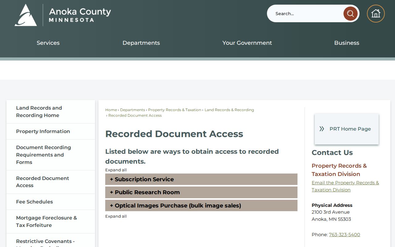
That access menu matters when a past residents search needs a record older than the visible online result or a copy tied to a document number.
Pair Blaine Directories With Census Years
Deeds describe title. Directories and census schedules add the household layer needed for previous residents. The Minnesota Historical Society finding aid lists Blaine telephone-directory holdings from 1957 through 2011, with print, yellow-page, and microfiche variants and a displayed gap at 1993. A directory gives a listed subscriber or business address at publication time. Check the front matter and abbreviation key first, and never assume the volume includes a reverse or criss-cross section.
- Choose the directory edition closest to the deed or permit date and record its year, page, printed name, address, and any listing notation.
- Check adjacent annual or near-annual editions for a changed spelling, initial, spouse notation, or address. Record a departure as a dated clue, not a certainty.
- Match the resulting address to the nearest accessible census schedule. The 1905 Minnesota census collection can include street or rural route address, household information, and residence length.
- Compare the directory and census dates against the deed chain. A directory listing before a sale can identify an earlier subscriber, while a later listing can identify a later one.
- Use an obituary, death index, or probate file only as a dated bridge. Minnesota Court Records Online (MCRO) is the court access route for public probate material, subject to its access limits.
A broader explanation of the physical and catalog collections appears in the Blaine city directory. For a house-history trail, keep the collection details concise and use the directory only where it advances the one-address time line.
Blaine Telephone Books Leave Dated Clues
The MNHS telephone-directory finding aid is unusually specific for Blaine. It records exact shelf and fiche holdings, including multiple print and yellow-page variants for some years. The holdings should not be relabeled as a verified continuous municipal directory or assigned a publisher without checking the title page. The FamilySearch catalog also lists a 1976 Anoka-Blaine-Coon Rapids directory, but catalog presence does not mean that public images are available.
For past residents, a reverse section can be valuable because it can begin with an address and point to a listed subscriber. It is still a dated subscriber clue, not proof of title or every household member. Record the page and edition beside the address. That modest detail makes later census, obituary, permit, or deed comparisons possible.
Note: The displayed 1993 gap in the MNHS finding aid is a collection gap to verify, not proof that no person lived at a Blaine address that year.
Date Blaine House History With Permits
Blaine Property Information separates its address record trail at October 5, 2020. iMS contains permits after that date, and DocuWare contains earlier permits plus all Certificates of Occupancy, Landscape Surveys, and Surveys. The iMS summary says permit history reaches back to May 1998. These records can date work, inspections, certificates, or an alteration period at an old address. They do not prove that an applicant, contractor, or permit holder lived there.
When an address search does not expose the needed material, use the Blaine public-data request form under the MGDPA. Provide the address, exact date range, and whether the request concerns permits, inspections, certificates, surveys, or code material. The City Clerk's route includes classification and fee handling, so a narrow request is more useful than a broad name search.
Use Blaine House-History Help
The Anoka County Historical Society research guidance points house-history researchers to its Hunting House History material and research-request service. Staff ask for a specific question, exact address or date, and known owner names. The first approximately 15 minutes of research are free, after which the stated rate is $20 per hour, with 25-cent copies and postage. ACHS holdings add maps, ownership plats, newspapers, obituaries, cemetery material, vital announcements, photographs, and personal papers to the Blaine address trail.
The historical society's research guidance presents the preparation and request route for a focused house-history question.
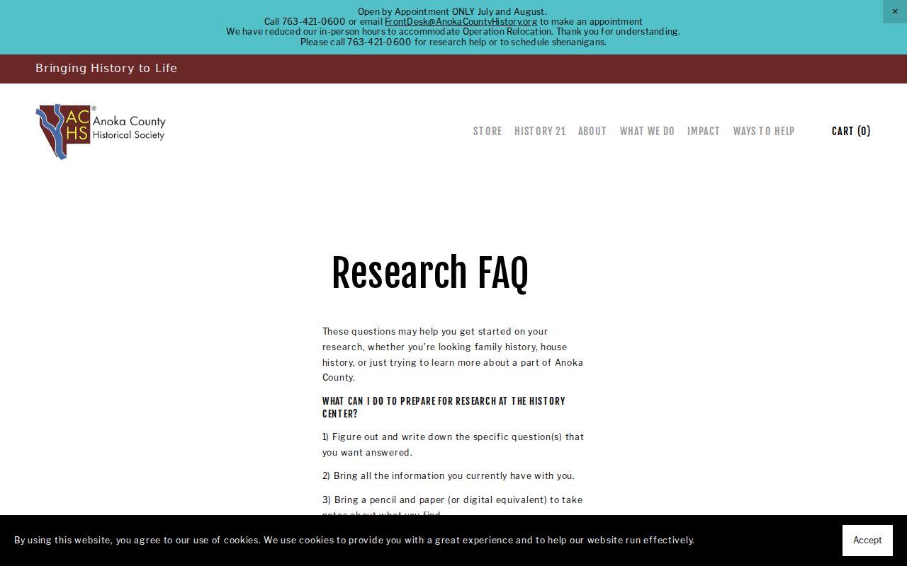
A focused question with an address, date range, and known parcel or owner details gives staff a usable starting point for maps, newspaper, and archival searches.
Blaine History Can Change Address Labels
Blaine's record geography has a local history. The city's history says that the area was considered part of Anoka until 1877, when Blaine separated and organized as a township. Circle Pines and Lexington later took land from areas that had been Blaine and Centerville. This is a useful historical caution: a household tied to an old address may appear under a different municipality label even when the land is part of present-day Blaine.
No official Blaine street-renumbering or renaming year was found. When a historic address does not return a parcel, retain the old and modern forms, then work from the legal description, lot, block, plat, and PIN. ACHS ownership plats from 1888, 1914, and 1932 and maps from the 1850s onward can provide the geographic bridge. Green Chambers, whom the city identifies as a permanent Blaine settler in 1865, is an example of why a date and historic locality matter more than a modern address label alone.
Respect Limits on Blaine Previous Residents
Past residents research should distinguish a public title record from a dated household clue. A deed may establish a transfer. A directory may identify one listed subscriber. A census page may show a household on its enumeration date. Protected records, unlisted telephone information, utility and delivery records, driver information, and the real address of a Safe at Home participant are not ordinary public address sources. An absence from an available source is not proof that nobody lived at the address.
Verify a significant conclusion with the custodian that holds the record, and retain the record date with every note. That practice keeps past-residents research useful for family, estate, and property history without turning a historical trail into a claim about a living person.